The Coastlines of India - Why the west has more ports than the east
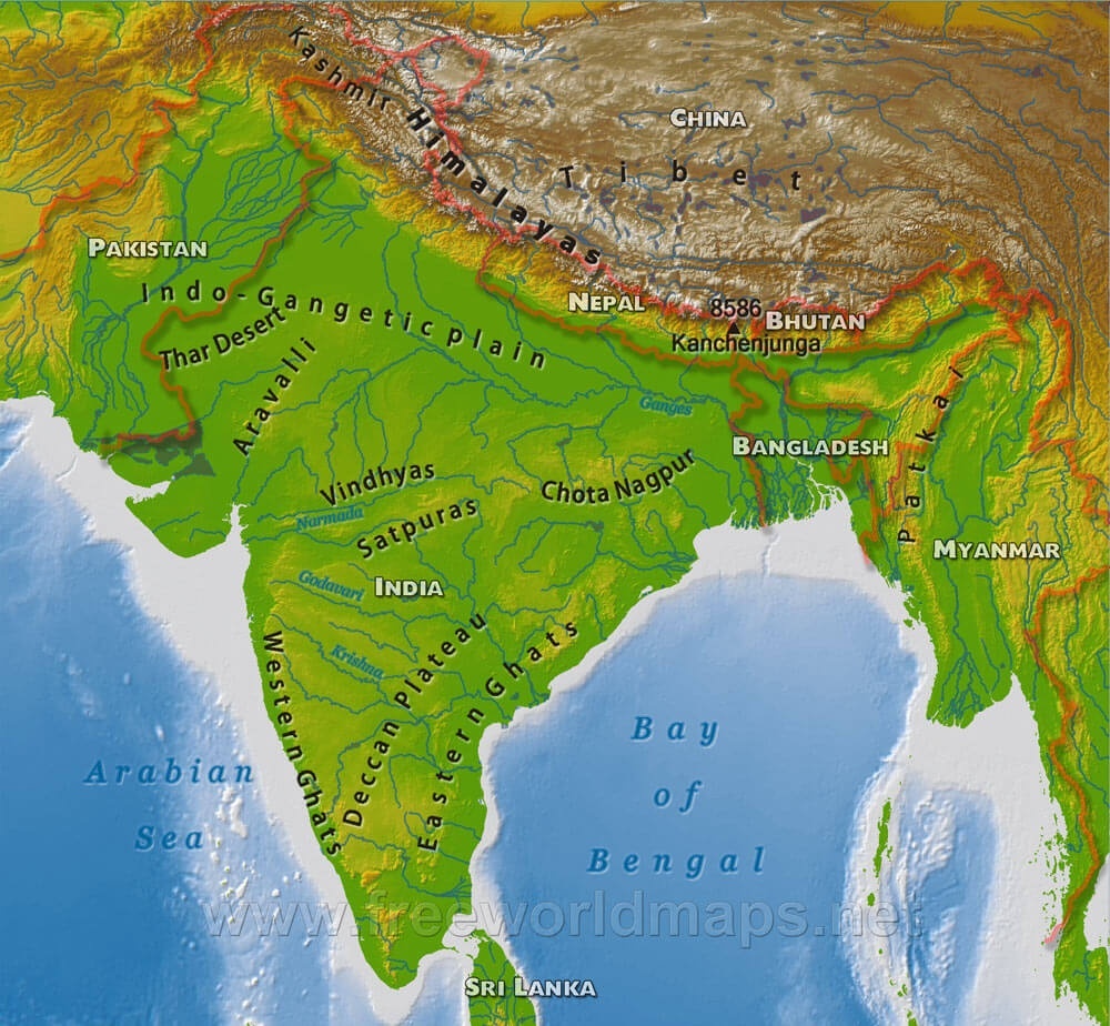
Emergent and Submergent Coastlines
First, there needs to be an understanding of what emergent and submergent coastlines mean. The coasts of Emergence are coasts that experience a relative fall in sea levels. The term “relative” implies that the sea level can “fall” due to a rise in the coastline landmass as well.
In contrast to this, submergent coastlines (or Drowned Coastlines) are those that experience a relative rise in sea levels. These coastlines are formed either when the sea level rises or the land level falls.
Among the Indian coastlines, the entirety of the western coast except for Malabar, is a submergent coastline, while the eastern coastline is emergent (especially the southern part of it along Tamil Nadu).
These characteristics of the coasts imply that the west coast gradually gets deeper with time, while the east coast is the opposite - it gradually gets more shallow. When a ship is entering a port, typically, a deeper sea bed is preferred so that the hull of the ship does not hit the bed way before it is even at the port. This also means that, generally, the ship enters an emergent coastline preferably when the tide is higher. [1]
River Deltas
Generally, the emergent coasts have a rocky coast, with uneven and steep gradients due to the submerged parts of the coast emerging gradually. But the eastern coast of India is not as rocky and is also not as steep as is expected of an emergent coastline.
This is because of the presence of large rivers that drain out into the eastern coast, carrying large volumes of water at high flow rates. These large rivers also have deltas at the river mouth which supply large amounts of sediments, which are carried along the river’s course of flow. This gradual sedimentation results in a gentler slope than is expected of an emergent coastline.
A gentler, gradual slope means the water is more shallow near the coastline, which as reasons mentioned before, makes it naturally difficult for ships to port.
In contrast, the western coast also has a more steeper gradient. This is because the western coast is smaller in width compared to the eastern coast, and the western ghats are much higher than its eastern counterpart. Both these factors contribute to a steeper gradient along the western coast. Also, the western coast has no large rivers carrying large amounts of sediments along their flow. The western coast has estuaries, unlike the deltas of the eastern coast. Lesser sedimentation means the topology is not “stabilized” or “averaged out” to a more gentle gradient.
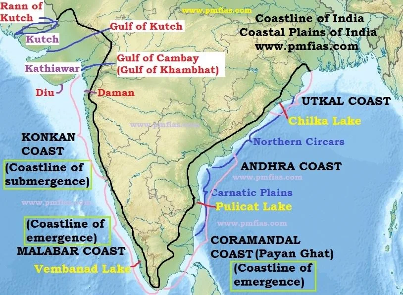 Wider Eastern coastline of India
Also, larger river deltas mean a larger flow rate of water through the rivers, which is prone to creating more unsteady disturbances along the river mouth, which is unsuitable for a port. The western coast with its estuaries is more naturally suitable for ports.
The character of the Bay of Bengal
The Bay of Bengal in general is more “wavy” than the Arabian Sea and also experiences a higher number of storms. One of the reasons is that the Bay of Bengal is a more relatively “locked” sea, enclosed by landmass on multiple sides, unlike the Arabian Sea. This aids in wave reflection and wave enhancement.
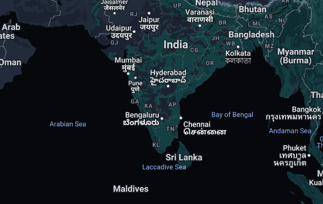 Bay of Bengal is locked by landmass on multiple sides
Another factor influencing wave development is the depth of the waters near the coast. As mentioned before, the eastern coastline is more shallow compared to the western coast. This aids in an effect called Wave Shoaling. As waves approach shallow waters, to maintain energy conservation, the waves should have a higher energy density to compensate for a decrease in their transport speed, thus leading to taller waves.
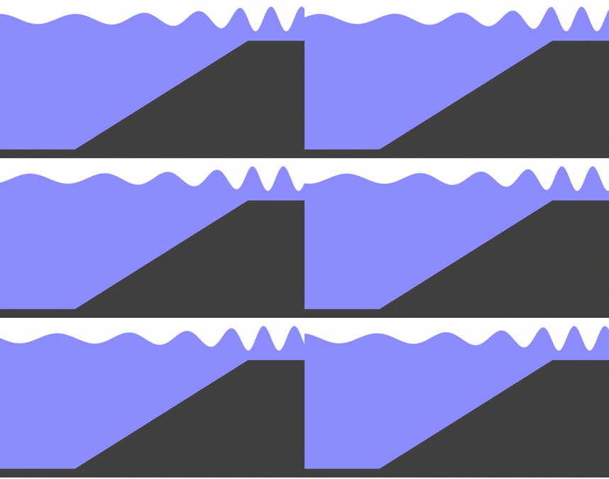 Wave Shoaling
The Bay of Bengal also experiences relatively more cyclones and storms than the Arabian Sea. Cyclones require warmer sea temperatures to provide the necessary heat and moisture to fuel their development. The Bay of Bengal often has warm waters, especially during the pre-monsoon and monsoon seasons, which are conducive to cyclone formation.
Geo-political connectivity
Historically, the western coast of India has been a major hub for maritime trade. The Arabian Sea has been a significant route for trade with the Middle East, Africa, and Europe. Ancient ports like those in Gujarat (e.g., Surat) were key nodes in the trade networks of the Indian Ocean.
The western coast’s proximity to the Persian Gulf and the Middle East, hence, enhances its strategic importance. This region is crucial for energy imports, especially oil and gas, from the Middle East. Ports on this coast are well-positioned to handle these imports, making them vital to India’s energy security.
Also, during the colonial period, the British established and expanded port infrastructure on the western coast to facilitate trade and resource extraction. This legacy has had a lasting impact on the region’s port development, with many colonial-era ports continuing to be major commercial hubs.
Footnotes
[1] This should not be confused with the blog cover picture, which may be interpreted to mean the coast is more shallow along the western coast. To clarify, this image shows the continental shelf along the Indian coastlines. Continental shelves are the portion of the continent which are submerged under an area of relatively shallow water. While the western coast does indeed have a wider continental shelf than the eastern coast, it needn’t mean that the western coast is more shallow than the eastern coast. The factors of large river deltas facilitating sedimentation, and the eastern coast being a coast of emergence are also factors which contribute to the depth of the coastline.